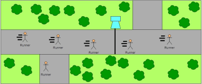
A wireless sensor network that will utilize computer vision and mesh networking will be used to track the usage of the Lehigh Valley trail. The network will be comprised of a series of modules that use image sensors to recognize commuters and their modes of transportation. Additionally these modules will communicate with one another to determine which entry and exit points commuters are using to access the trail. The network will have a gateway node that allows the data to be back-hauled to the internet. This data will then be stored via cloud storage and accessible via a web interface.
Sponsored by:

